
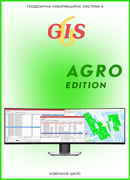
Geodetic Information System 6 Agro
Land bank management solution
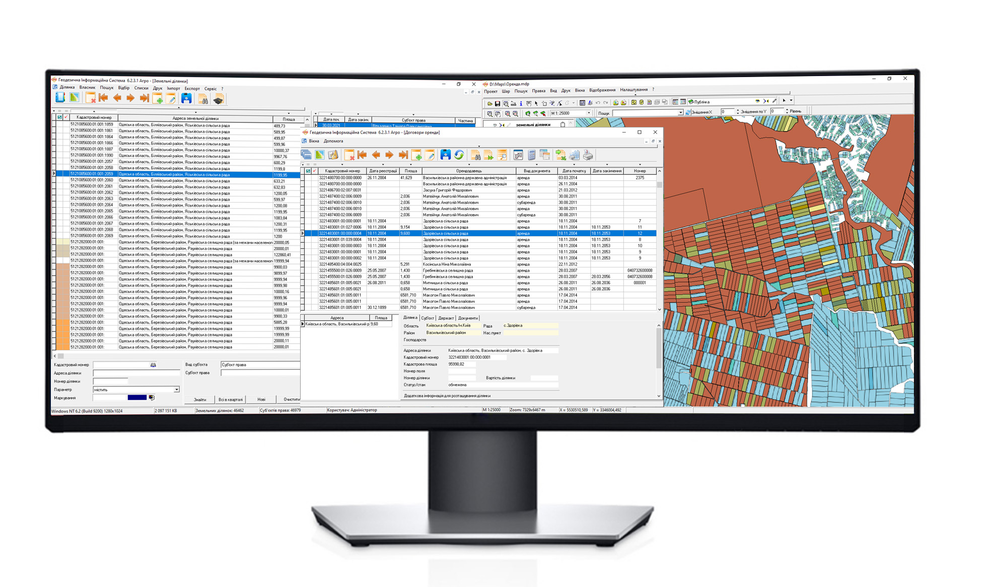
GIS 6 Agro – The network version of the program for managing the land bank of an agricultural company. The program consists of several multifunctional modules that provide functionality for keeping track of land plots, crop rotations of fields, all types of ownership and use of land plots, provide an opportunity to monitor the duration of lease agreements and exchange information with external solutions. Advanced analytical and search tools allow you to quickly find a site, analyze information and print reports.
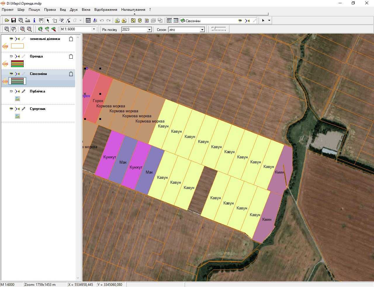
Built-in mapping module MapDraw 2 provides the ability to connect and display external raster and vector layers ArcView/ArcGis together with the internal layers: land plots, fields, crop rotation, on-farm structure, soil characteristics, rent and others. In addition, the module allows you to upload images from public map servers, such as: Public Cadastral Map of Ukraine, Google Map and others. There is an opportunity to customize the display of land plots for various parameters, for example, depending on the number of days before the end of the lease.
Module Cameral functions provides functionality for designing and editing the topology of land plots, sharing of plots by area, cost or number of owners. In the module Lease agreement the whole register of concluded lease and sublease land plots is displayed with the ability to quickly search, select or change parameters. Integrated module FastReport allows you to create templates for the formation of reports of any complexity and content.
Professional land bank management system
Keeping records of fields, land plots and lease agreements
Appointment
- maintaining a single land bank;
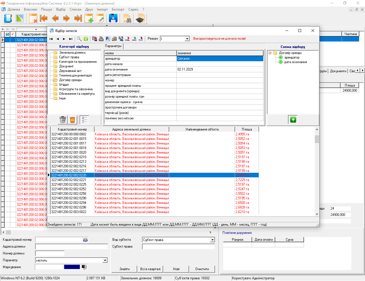
- maintaining and monitoring the registry of lease agreements;
- connection, storage of scanned and other materials in a single repository;
- designing, sharing of land (shares);
- formation of reporting.
REGISTRY AGREEMENTS RENT
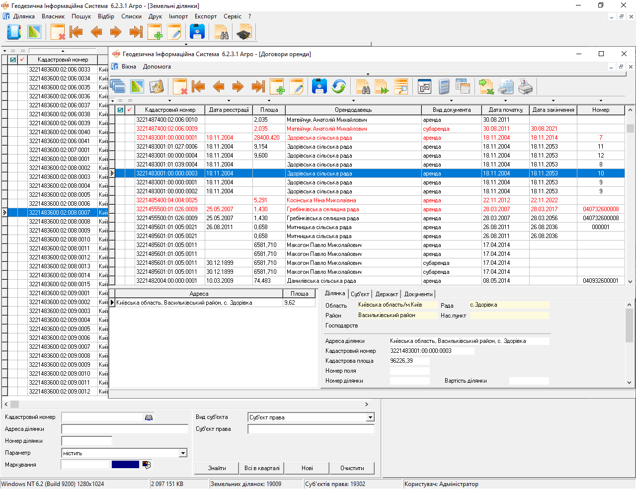
DISPLAYING AGREEMENTS RENT TERM OF ACTION
DISPLAY OF FIELDS AND CROP ROTATION
DISPLAY OF FIELDS AND CROP ROTATION
Features
- support for importing data from external sources;
- built-in module FastReport for generating reporting of any complexity;
- support for importing/exporting data from files MS Excel;
- generating reports in MS Word;
- connection of coordinated images;
- download satellite images from map servers GoogleMap and others;
- loading of substrates from the Public Cadastral Map of Ukraine, search by cadastral number;
- automatic calculation of distance, perimeter and area of land plots;
- availability of search tools, selection of data for information analysis;
- automatic assignment of cadastral number through the service of the National Cadastral System on the geometry of land plots;
- storage of connected scanned and other materials in a single storage;
- designing and sharing of land by area, cost, and other.
| Program features | GIS Pro | GIS 6 Agro |
|---|---|---|
| Improved interface | ||
| Field registry | ||
| Crop rotation register | ||
| Register of land plots | ||
| Registry of lease agreements | Advanced | |
| Register of state acts | ||
| Rental payments registry | ||
| Module "Cameral functions..." | ||
| Module "Map" | ||
| Import and export of exchange files of land cadastre information In4 and Xml | ||
| Import objects from the file in the format Dxf, Shp, In4, Xml, Kmz, Kml, Dmf, Mif, Txt, Dbf, Sdr, Wor, Art, In4, I15, Gbd, Cat | ||
| Import from MS Excel (for agricultural holding) | ||
| Performing data assignment operations with a group of objects | ||
| Auto assignment of cadastral numbers to land plots through the service "NCS" | ||
| Connecting and coordinating images Tif, Sid, Jpg, Gif, Bmp | ||
| Connection internet cards GoogleMap, Public Cadastral Map of Ukraine and other | ||
| Information import from State registers through the online service "OpenDataBot" | ||
| Search and filter data |
Completion
- installation;
- electronic USB key;
- settings for the updates;
- annual support of the program.