
ГІС 6 Веб-рішення
GIS 6 Web Edition allows you to simultaneously work with the database within a corporate network using GIS 6, or remotely via the Web interface. A unique opportunity to create and edit templates reporting forms on-line. Patterns of reporting forms can be both a server GIS 6 Web Edition and locally on the client. Is present to export the generated documents in spreading formats Doc, Xls, Pdf, and others. Scalability GIS 6 Web Edition allows you to create a complete website. The solution is designed based on technologies Apache Tomcat 7, Java, MS SQL Server 2008, Spring, Hibernate, Html, Css ...
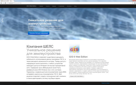
Solution for land management
With the help of GIS 6 Web Edition developed by ShelS Company your business will significantly expand the scope of application and the use of geography. The solution allows you to work through a Web interface to GIS 6 Web Edition and EJRC 2 Web Edition. A single administration panel pozvoyaet to access and distribute rights Fi for users.
Get more
The solution allows not only to work with GEO-information system, but also to create a corporate website, as well as merge the work of remote offices and employees. The administrator can configure the interface solutions and options to suit the needs of the customer.
Loyality programm
Join a user group GIS Web Edition 6 now and get a discount on an innovative solution for your business.
Additional characteristics
Now access to information can be made from any device with access to the Internet or the corporate network. The server side of web-based solution can be deployed in both MS Windows and Unix systems. Options and rules of user access through a web interface are similar to GIS users 6. The solution is developed on the basis of Apache, Java, Adobe Flex, MS SQL Server, GisMapServer and Google Map technologies.
The current version demonstrates the possibility of technology using for providing of rapid access to GIS software 6 via a web interface. Besides the standard facilities for GIS software 6 The Web solution allows editing and visualization of geo-spatial databases created by the user, perform Online tracking of objects with the specified GPS tracker devices, manage the database of scanned materials and other files, display graphical representation of the operational statistical information.
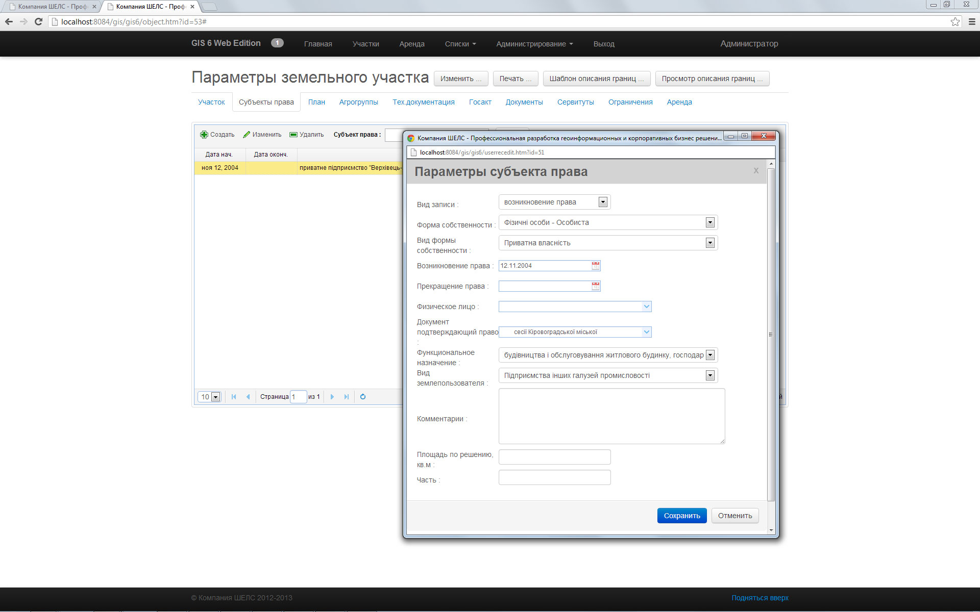
Creation and editing of geospatial databases that are created by the user. The ability to vector through a web interface and edit the semantic information.
Visualization of geo-spatial databases that are created by the user. The ability to use color fill, depending on the values; of semantic information in the databases.
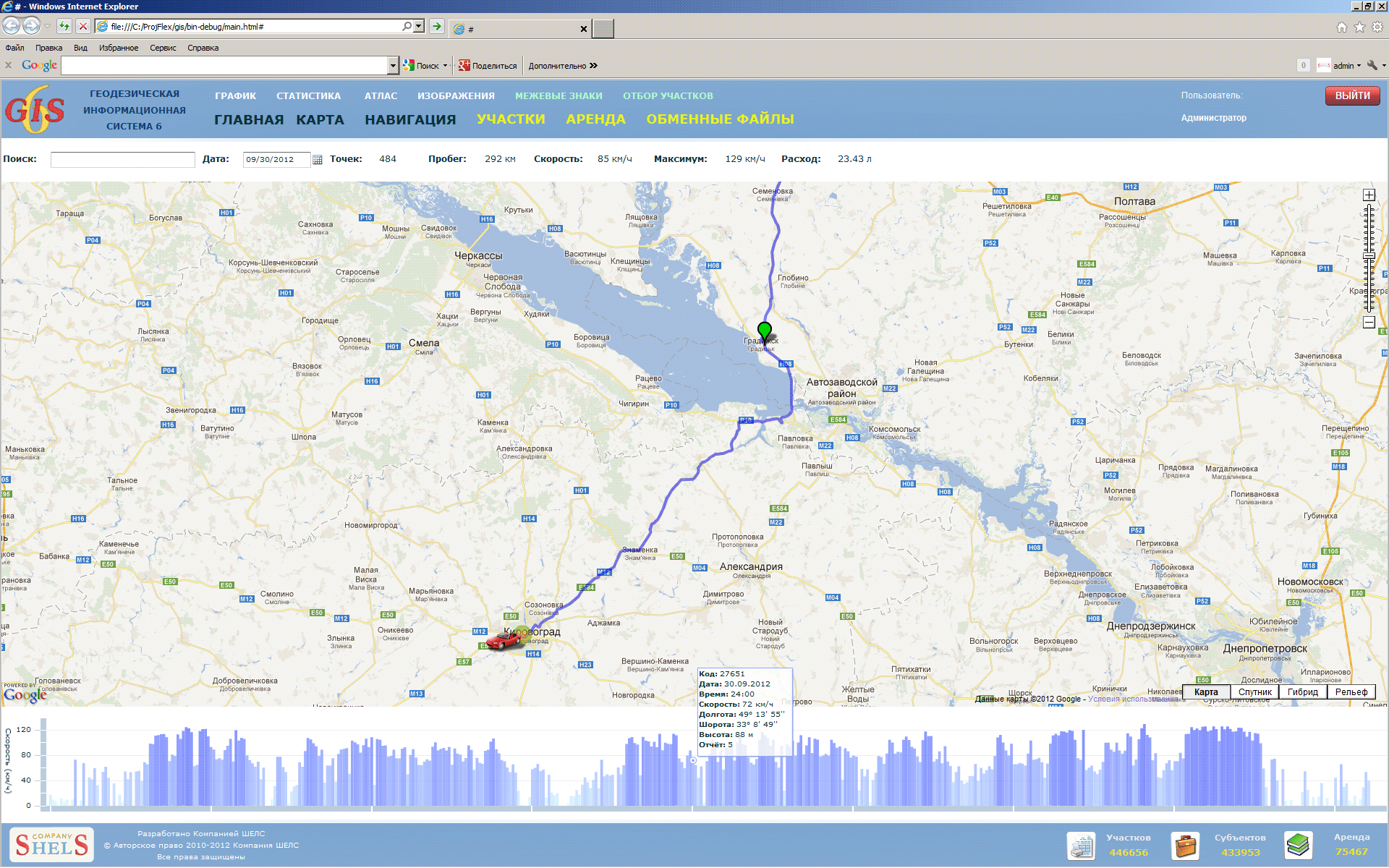
Displaying of shifting of mobile applications that transmit location with the help of using the GPS tracker device. Ability to obtain information for the selected period. Displaying mileage and fuel consumption.
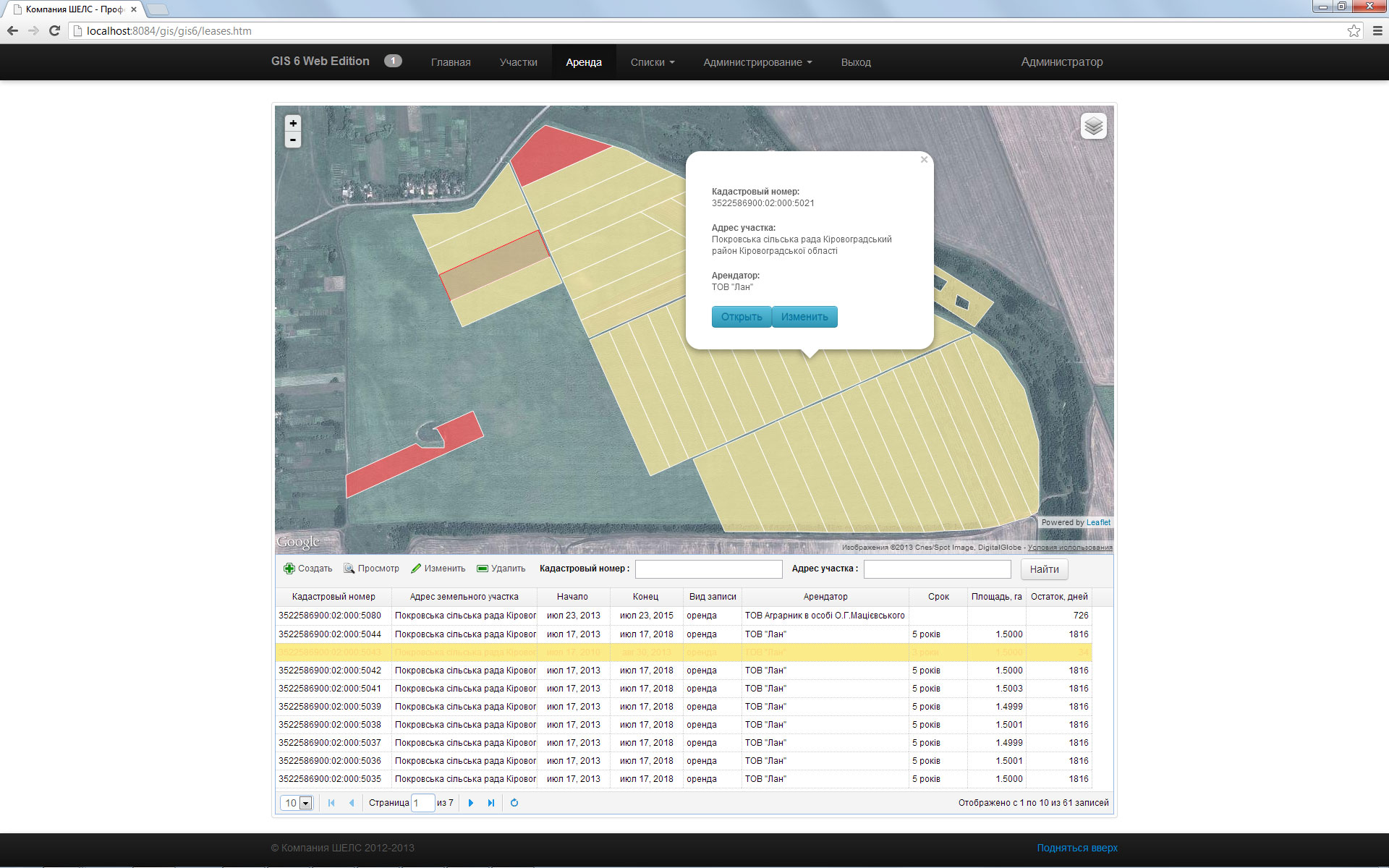
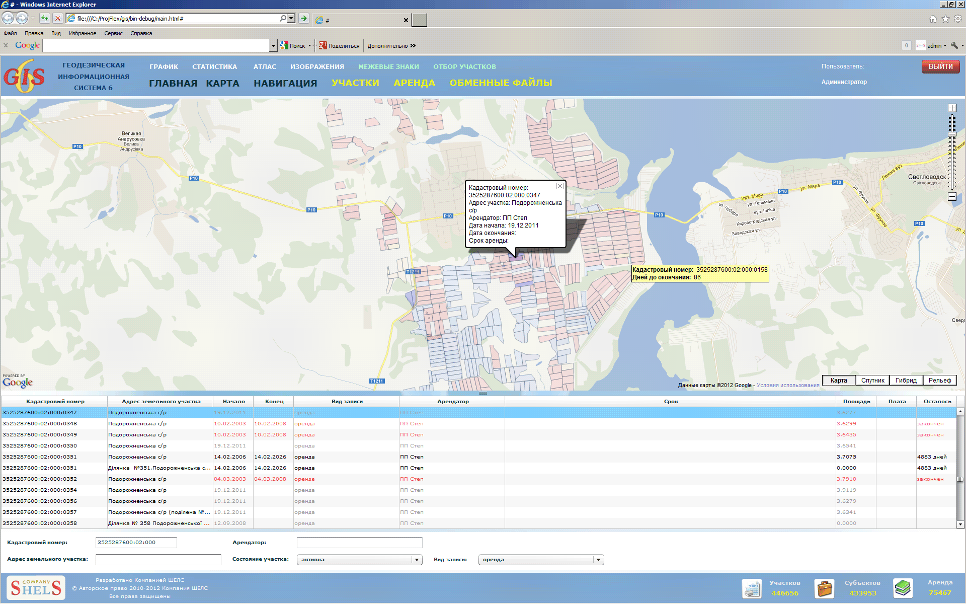
Selection of leases by the code KOATUU, address of land parcel, lessee, conditions of parcel and type of contract. Mapping on Google Map of leases with filling of corresponding number of days before the end of the lease term. Highlighting of the selected records and information.
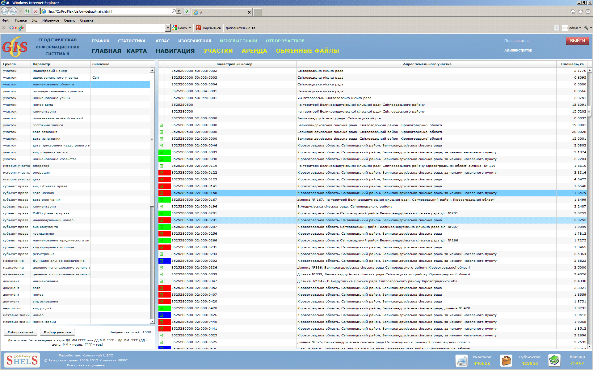
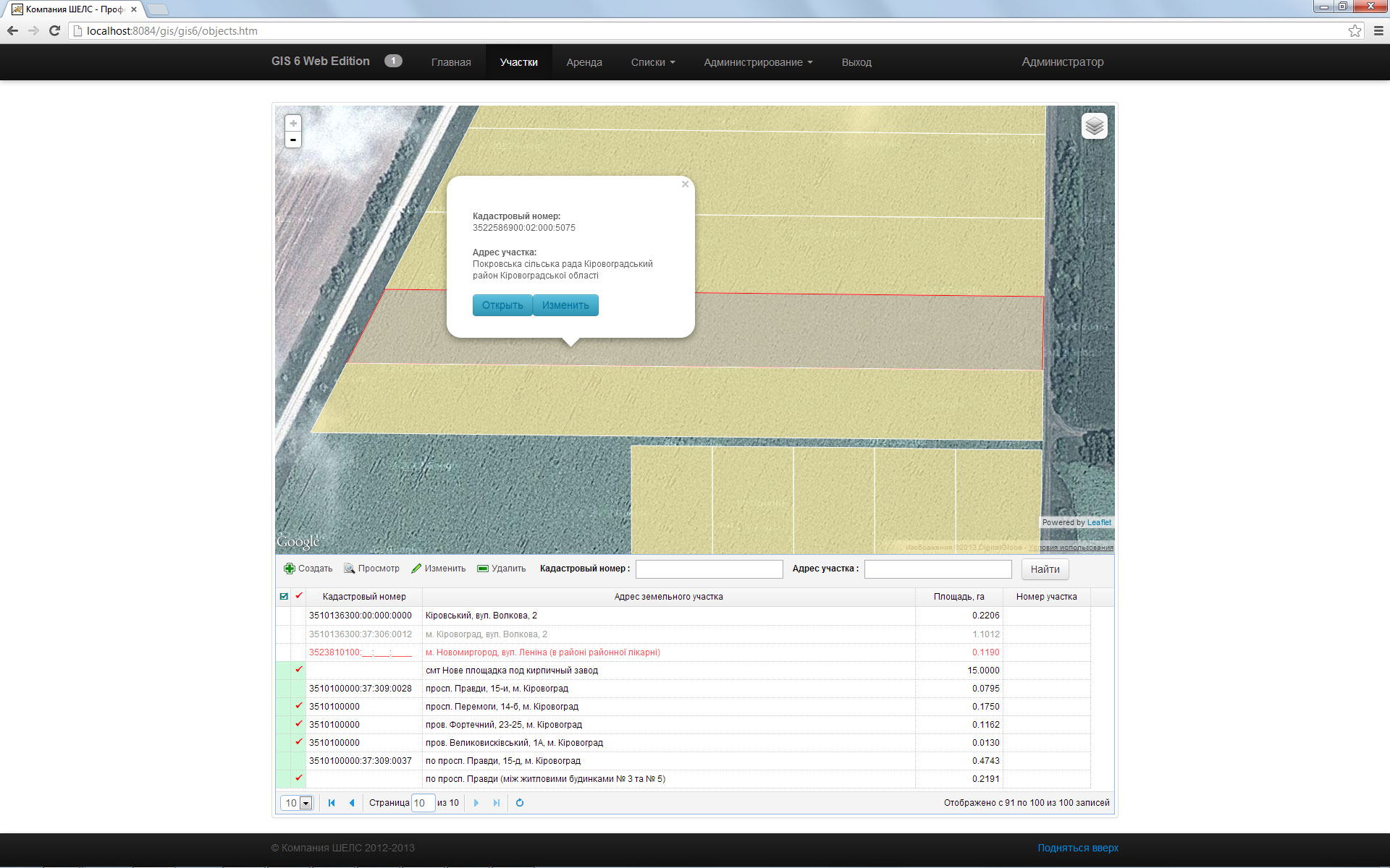
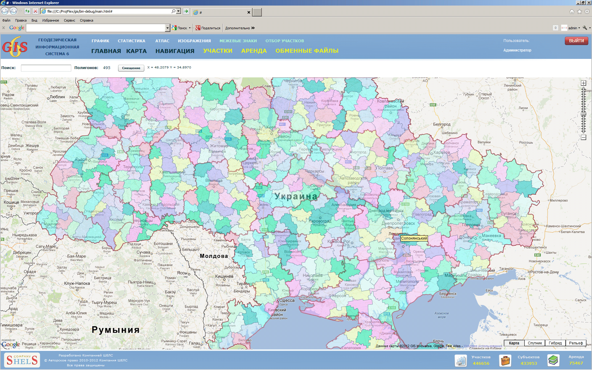
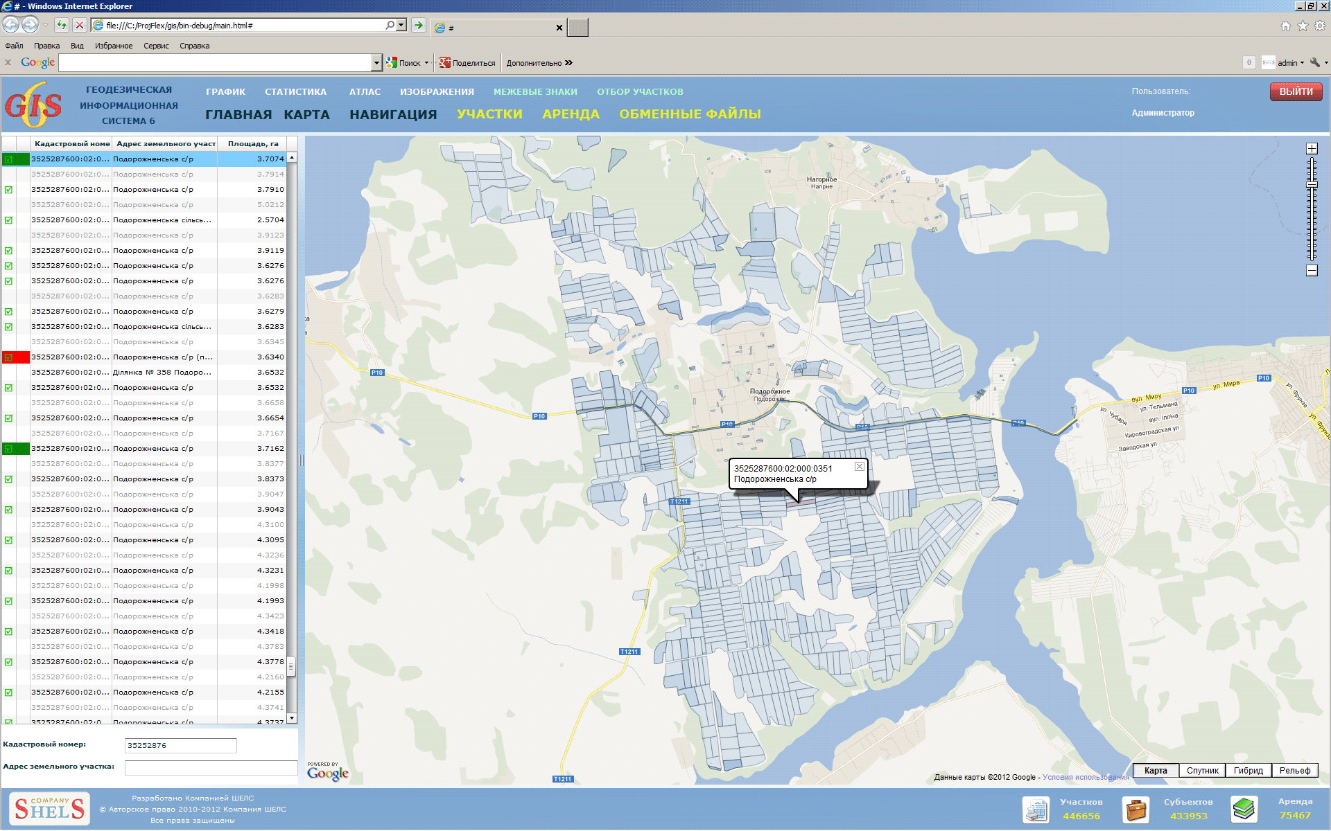
A full selection of parcels similar to those of GIS 6.Colouring, marking and recording status are displayed in the list of parcels . It is possible to display the options of selected parcel.
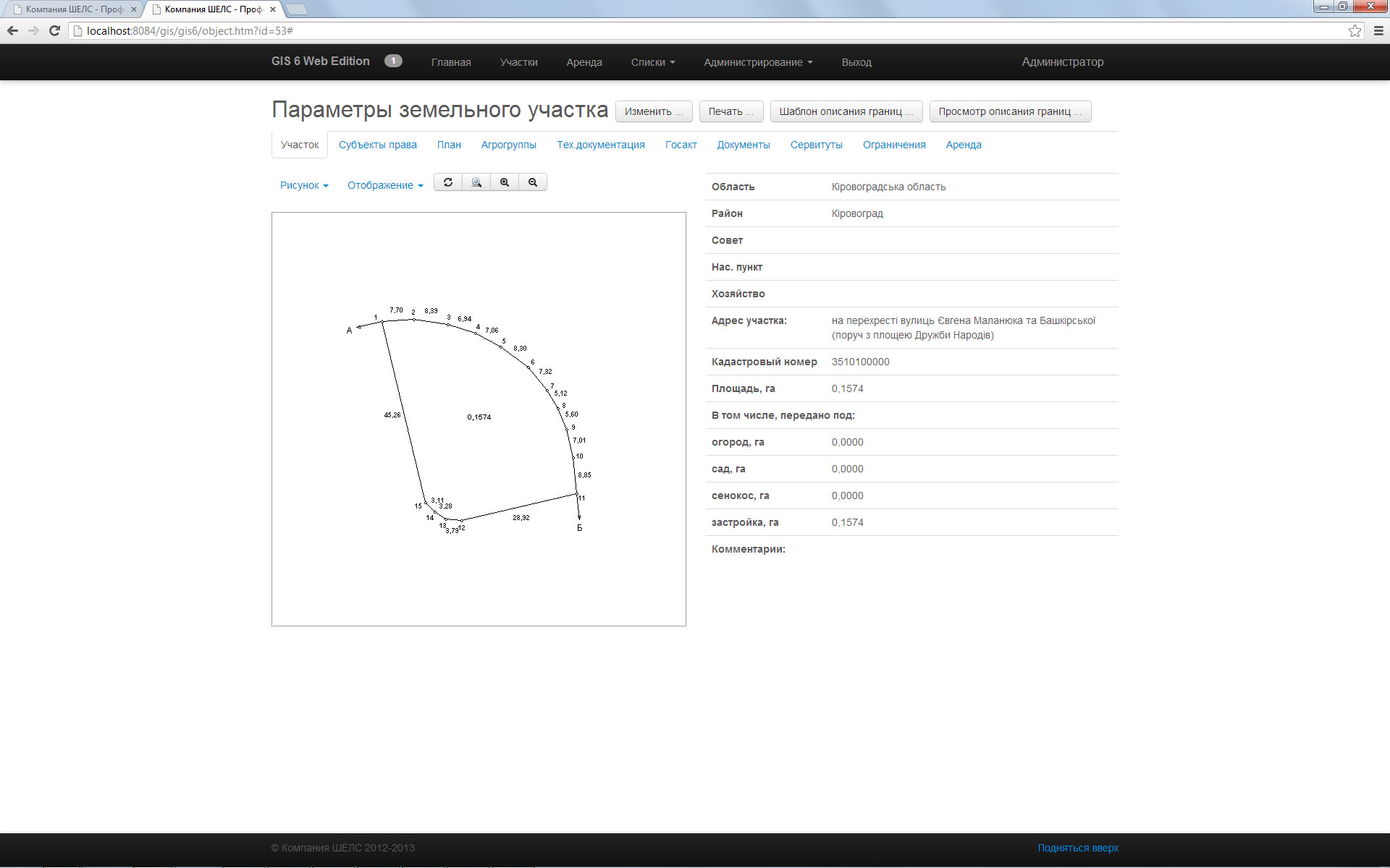
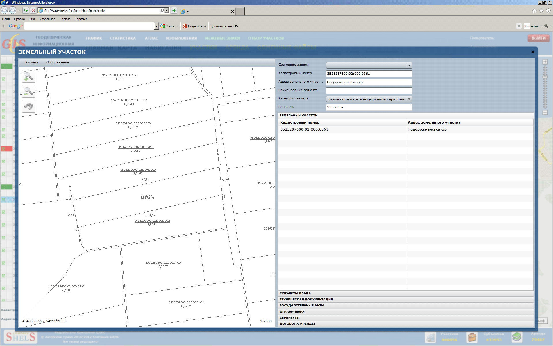
Displaying of the boundaries and options of the land. Figure of plot maximum corresponds to the display in the "Desk top features ..." GIS software 6. Lists of data related to the selected land.
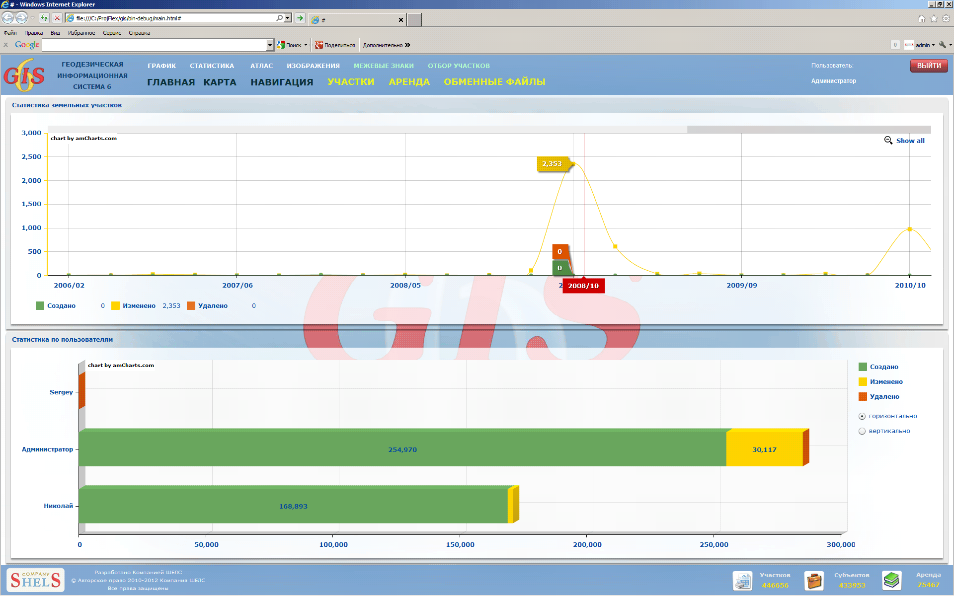
Displaying graphs assign inventory numbers for the selected period, the statistics on the state of land, monthly information about the created, modified and deleted records.
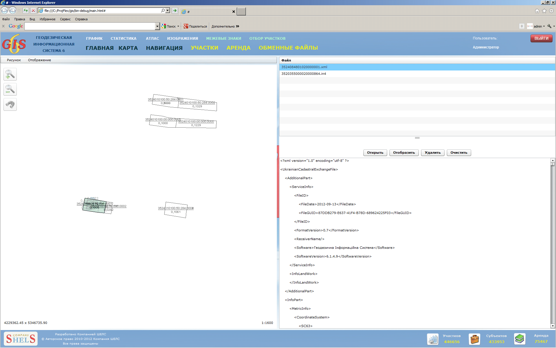
Displaying of selected exchange files in XML and IN4 map format allows the verification of overlay with other land.