
GisMapServer

Map server for the internal layers of the program Geodetic Information System 6 and external layers supported by the program MapDraw 2. An application allows substantially to speed up the process of image formation for a client, to release the traffic of local network, and also to secure access to vector and image data stored on the server. GisMapServer can also be used as an Internet Map Server. This technology allows to obtain mapping information in the user applications. HTTP requests can contain the coordinates of the center of the image, the scale, size and format of the resulting image. Java, С# and Delphi are examples for work with cartographic and web server and come with the program.
Map server supports the following layers:
General internals
- cadastral zones
- cadastral quarters
- land parcels
- types of land parcel
- soil description
- easements
- restrictions
- rent
Externals in the format of MapDraw 2
- imeges (Bmp, Wmf, Jpg, Tif и Sid)
- cosmetic
Internal money estimation
- boundaries of settlements
- assessment area
- soil description
- local factors
- slopes
Externals in the format of Shp/Shx/Dbf of the program ArcGis/ArcView
- points
- lines
- polygons
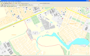
Displaying vector layers in the GIS 6 program
Example GISMAPCLIENT
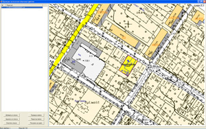
Displaying raster layers in the GIS program 6
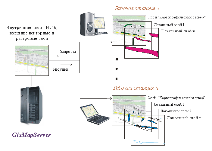
Scheme of cooperation of GisMapServer with the program GisMapClient
The program GisWebClient is designed to test the stackling of exchange file in Xml and In4format. The program works in with a map server GisMapServer. It allows you to check the location of the selected files relatively to the existing exchange of raster and vector information of the enterprise. The program is provided with the connection of an external editor, and check of exchange files, positioning on the selected exchange file , arbitrary scaling and shifting. For users of GisMapServer the program GisWebClient is free.
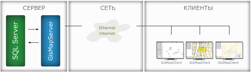
Scheme of GisMapServer interaction with the program GIS 6 and MapDraw 2
Completion
- Installation
- User manual
- The settings for the updates
- Program Support

| Version | Description | Price | |
|---|---|---|---|
| GisMapServer |
GisMapServer - GIS and MAP Server GisMapClient - IDE program for desktop GisWebClient - WEB panel for remote desktop Java, С# and Delphi examples |
US$1260 |