SEMINAR-TRAINING GEODETIC INFORMATION SYSTEM 6
23-24 may 2013
venue of Kropyvnytskyi, st. Ordzhonikidze, 7, rm. 501
(Business-Centre "Elvorti")
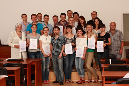
23-24 may 2013 representatives of 13 regions: Mykolayiv, Poltava, Odesa, Zaporozhye, Ternopil, Kharkiv, Donetsk, Kiev, Kirovograd, Cherkassy, Zhytomyr, Chernihiv, Dnipropetrovsk and AR Crimea visited the two-day seminar-training "Geodetic Information System 6", which was devoted to the formation of the exchange file cadastral and land information in the format
XML, in accordance with the Order of the State Committee №
573 from 02.11.2009, Resolution of CM № 1051
from 17.10.2012, and the requirements of the National Cadastral System (NCS) the formation of data exchange file
XML, creation of land, easements and restrictions, the transformation of the local coordinate systems and methods of transformation in
USK 2000, connection to Public cadastral map of Ukraine (PCMU). This is the seventh workshop for project organization, which conducts
ShelS Company. The main objective of these training-seminars -
form practical skills program
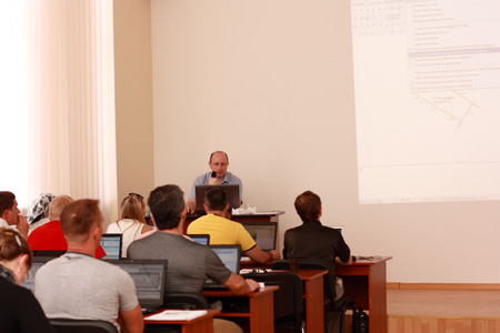
GIS 6. The topic under consideration is so relevant today, that was a record number of participants for all years of the - 60 people.
The first day was devoted to reviewing the features of the program
GIS 6; the latest developments ShelS Company; create, import and filling of land, the coordinate transformation from the local to
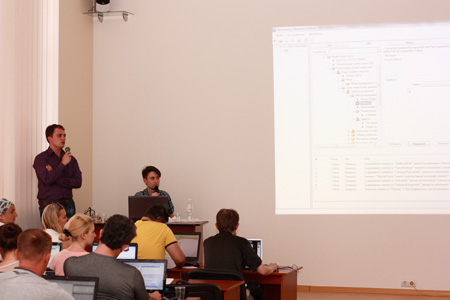
SC 63 and USC 2000; export and check the exchange file land cadastre information in XML. In the second day of the workshop, participants learned about mapping module
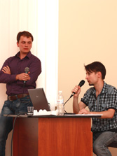
MapDraw 2; assignment and replacement of field values for a group of plots. At this seminar also covers administration, creating and restoring databases, configuring network access to data. Nobody stood aside, experts
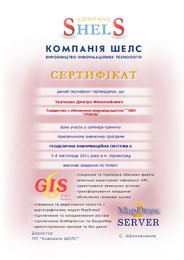
ShelS Company answered all the questions. According to the results of the training seminar, each participant received a nominal
Certificate, confirming the acquired knowledge.
ORGANIZATIONAL MATTERS
Date: May 23-24, 2013.
Event venue: Ukraine, Kirovograd, st. Ordzhonikidze, 7, rm. 501 (Business center "Elvorti)
Terms: classes focus on hands-on learning work program GIS 6, therefore work more efficiently participants, it is desirable to take seminar-training notebook
The cost of participation: one day of participation - 500 UAH for 1 person, two days of participation - 800 UAH for 1 person.
The price includes: participation in training seminar, training materials, CD with training materials and Certificate.
SEMINAR SCHEDULE
| 15.05.2019 | 16.05.2019 |
|---|---|
| 09:00-10:00 - arrival, registration of participants; | 10:00-18:00 - conducting a training seminar with a break; |
| 9:00-17:30 - conducting a training seminar with a break; | 17:30-18:00 - departure of participants. |
SEMINAR MATERIALS
PROGRAM SEMINAR
Day 1
1. Overview of the program GIS 6
2. Creating land plots
3. Complete data on the subjects of rights, restrictions, easements, rental
4. Perform auto-complete search, selection and analysis of data
5. Coordinate transformation from the local coordinate system SC 63 and SC 63 from USC 2000
6. General information about the interchange file format XML
7. Setting export and optimization by Decision 1051
8. Setting export to the National Cadastral System (NCS)
9. Import and export exchange files XML
10. Checking and Editing exchange files XML
Day 2
1. Understanding the "Cameral function", work with layers and tools
2. The contour plot, plan and balance check areas
3. Create subcontractors, setting display picture
4. Creating sites with internal circuits (binding and clippings)
5. Configuring and mapping land plots with different coordinate systems
6. Ознакомление с основами картографического модуля "MapDraw 2"
7. Connection of local layers and server space images GoogleMap
8. Create a layer "Internet card" and displaying Public cadastral map
9. Connecting raster coordinated the project and the current search area on the map
10. Updating the program, administration, database backup
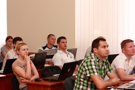
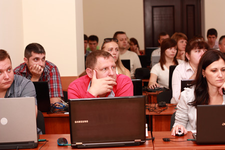
SEMINAR PHOTO MATERIALS