SEMINAR-TRAINING GEODETIC INFORMATION SYSTEM 6
May 15-16, 2019
venue Kropyvnytskyi, str. Elworthy, 7, room 501
(Business center "Elworthy")
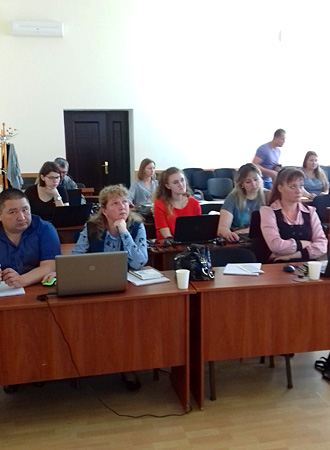
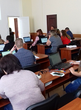
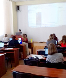
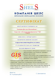
On May 15-16, 2019, representatives of 8 regions: Kyiv, Chernihiv, Sumy, Kirovohrad, Zaporizhzhia, Kharkiv, Dnipro and Odesa attended a two-day training seminar on the program Geodetic Information System 6 (GIS6), dedicated to the formation of an exchange file of land cadastral information in XML format, in accordance with the Resolution No. 1115 of 23.12.2015, the Resolution of the Cabinet of Ministers No. 1051 of 17.10. 2012 and the requirements of the National Cadastral System (NCS) when generating XML exchange file data, importing and calculating theodolite moves and pickets, creating land plots, restrictions and easements, transforming coordinate systems into USC-2000 and MSC-2000, connecting to the Public Cadastral Map of Ukraine and Google Maps. This is the twelfth training seminar for for design organizations held by Shels. The main goal of these of these seminars is to develop practical skills in working with the GIS 6 program and share experience with colleagues.
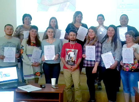
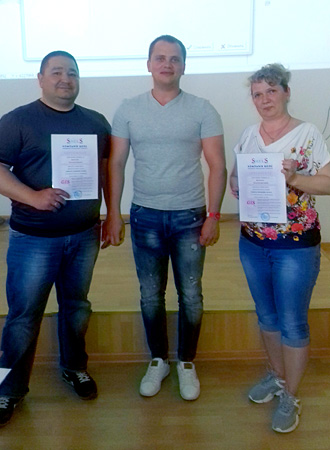
On the first day, the participants got acquainted with the capabilities of the GIS 6 program; general information about the Land Plots and Camera Functions windows; created land plots; filled in data on subjects of law, restrictions, easements, leases, and technical documentation; performed import and export exchange files in XML format; improved skills of using community directories (OTG); a separate version of GIS 6 Agrarian a separate version of GIS 6 Agro. The second day was devoted to processing measurements in the window "Calculation and alignment of theodolite moves and pickets"; creation of adjacent properties, easements; transfer of coordinates from SK-63 to USC-2000 or USC-2000 and vice versa; work with layers; familiarization with the basics of mapping module "MapDraw 2"; setting up the display of lease agreements lease agreements. As a result of the training seminar, each participant received a personalized certificate.
ORGANIZATIONAL ISSUES
Date of the event: May 15-16, 2019
Location: 7 Elworthy St., Kropyvnytskyi, Ukraine, room. 501, 5th floor (Elworthy Business Center).
Terms and conditions: classes are aimed at developing skills in the GIS 6 program. Therefore, for more efficient work, you should have a laptop with you.
Cost of participation:
If you pay by April 30, one day of participation costs UAH 800 per person; two days of participation costs UAH 1400 per person.
If you pay from May 01 to May 14, one day of participation costs UAH 1000 per person; two days of participation costs UAH 1800 per person.
The price includes: Participation in the seminar, coffee breaks, teaching materials, a CD with training materials and a Certificate.
REGULATIONS OF THE SEMINAR
| 15.05.2019 | 16.05.2019 |
|---|---|
| 09:00-10:00 - arrival, registration of participants; | 10:00-18:00 - conducting a training seminar with a break. |
| 9:00-17:30 - conducting a training seminar with a break; | 17:30-18:00 - departure of participants. |
MATERIALS OF THE SEMINAR
SEMINAR PROGRAM
Day 1
1. Overview of GIS program capabilities 6
2. General information about the "Land parcels" window, work with labels and filters
3. Import of measurements from GPS receivers and electronic total stations
4. Creation of land plots
5. Filling in data on subjects of law, restrictions, easements, lease and technical documentation
6. Use of directories of United Territorial Communities (UTCs).
7. General information about the "Camera Functions" window, working with layers and tools
8. Viewing areas on the map (map module "MapDraw 2")
9. General information about the exchange file in XML
format
10. Import and export of XML exchange files. Export settings and field completion check before export
11. Overview of the capabilities of GIS6 Agro
Day 2
1. Creating a site outline, plan and checking the balance of areas
2. Checking the topology and adjusting the plot area
3. Processing of measurements in the window "Calculation and alignment of theodolite moves and pickets"
4. Inverse geodetic problem or creation of information of the theodolite course without a real theodolite course
5. Creating adjacencies, adjusting the image display
6. Creation of easements and restrictions (polygons with internal contours)
7. Cuts and bindings (loops) in contours or areas with third-party land uses
8. Discussion of USK-2000 projection and geodetic points
9. Transfer of coordinates from SK-63 to USK-2000 or MSC-2000 and vice versa.
Using GISFile.com to transfer coordinates to USK-2000
10. Familiarization with the basics of the "MapDraw 2" mapping module
11. Connection of local layers, servers of space images of GoogleMap and Public cadastral map. Layer parameters, display
12. Setting the display of lease agreements
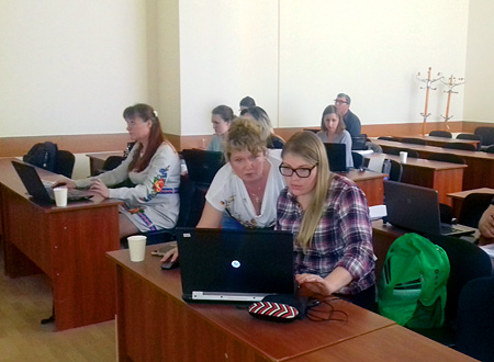
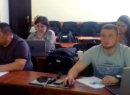
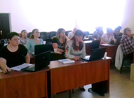
SEMINAR PHOTO MATERIALS